Pattern Change Brings Below Normal Temperatures
Just as the trees began to blossom and the flowers started to bloom all across Delmarva, everyone was getting used to the warmer temperatures. However, it appears that much cooler air will move into the area starting tomorrow (Thursday April 23). Is it short-lived or will the cooler air stick around as we head into May?
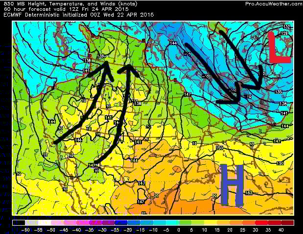
The pattern is about to change to a pattern we typically see during the fall and winter months. An upper-level low pressure in southern Canada is slowly moving east but will eventually stall out over New England for several days. It will sit there and usher in below average temperatures. Northwest flow directly out of Canada could drop lows into the 30s Thursday and Friday night.
High temperatures will only be in the upper 50s and lower 60s from Thursday to at least Monday of next week. Our average high temperature for today is 67 degrees and by Monday it will be close to 70. So temperatures will range anywhere from 5 to 15 degrees below average.
These patterns also sometimes spawn areas of low pressure off the Delmarva coast that could bring gusty winds and heavy rainfall. So we’ll have to keep an eye on that possibility too.
But for now, prepare for cool afternoons and chilly overnights for at least the next week starting tomorrow. If you’re a summer lover, unfortunately this pattern looks to continue into the first week of May at least, which means 80 degree days are not in sight right now.