Moisture from Harvey coming to Delmarva Labor Day Weekend
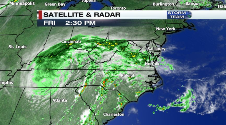
Hurricane Harvey made landfall last weekend as a category 4 hurricane near Rockport, TX. The storm caused catastrophic damage to areas along the Texas coast before stalling out and remaining in the same location for days. This is what is responsible for the 50” of rain seen around the Houston area. The storm eventually moved back into the Gulf of Mexico and made a second landfall in Louisiana. The remnants of Harvey are expected to move northeast towards Delmarva Friday night and Saturday.
The main reason the Houston area received such massive amounts of rain was due to the storm staying in one location. So even though we will see the remnants from such a destructive storm system, it will not be on the same magnitude of what was seen in Texas.
Here on Delmarva, we can expect to see steady rain Friday night with scattered showers throughout Saturday. There is the chance for severe storms Saturday evening and Saturday night, but the severe threat will be limited. A few showers may linger into early Sunday before the system finally moves into the Atlantic.
Rain totals from this system will be around 1” with higher totals possible in thunderstorms. Here are a few model outputs for rain totals:


Gusty winds are also possible Saturday afternoon. These are the expected top wind gusts:

The good news is that the rest of the Labor Day weekend is looking great! Skies will gradually clear out Sunday, and Monday will be mostly sunny with temperatures in the low to mid 80s.