Today’s Forecast: July 7, 2020
Partly cloudy skies are expected tonight with perhaps some lingering showers early. Temperatures will be in the low to mid 70s.
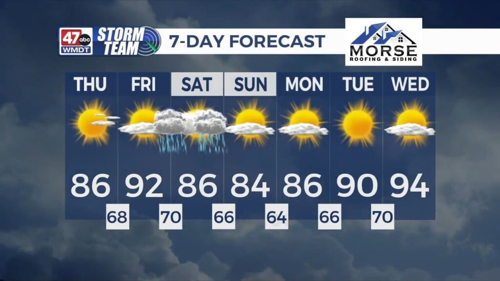
Wednesday will be partly to mostly sunny and humid with just an isolated storm chance, especially north of Salisbury. Highs will be in the upper 80s.
Thursday will see more cloud cover move in ahead of our next weather system. Highs will be in the mid 80s with a chance for showers late. Friday will have highs in the mid 80s under mostly cloudy skies and scattered showers. It will be quite humid too as an area of low pressure with some tropical characteristics moves through.
That system lifts north out of the area on Saturday, and hot temperatures in the low 90s take over. Some thunderstorms are possible late in the day. Sunday has highs in the upper 80s to low 90s with partly to mostly sunny skies. There is just a slight chance for a storm.
Monday will be mostly sunny and hot with highs near 90. Isolated thunderstorms are possible. Tuesday will be partly to mostly sunny with isolated storms and highs in the upper 80s.
Have a great night!
-Daniel