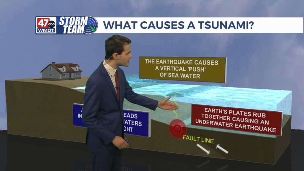
Weather Tidbits: Drought Categories
We’ll be discussing drought categories used in the drought monitor maps in this edition of Weather Tidbits. The drought monitor map is made from more than just precipitation deficits. It considers but are not limited to streamflow, reservoir levels, as well as temperature and evaporative demand. Observations and input from local area experts are all accounted for. By and large a collaborative effort. though of course, precipitation deficits are the most significant impact. Abnormally dry conditions bring short-term dryness that can slow planting and the growth of crops or pastures. If coming out of drought into onset conditions, lingering water deficit will be in place while pastures and crops will not have fully recovered. Moderate drought conditions bring some damage to crops and pastures. Some water shortages will develop or are imminent. This included low streams, reservoirs, and well water levels. Severe drought potentially results in the loss of crops and pastures. Water shortages are common and restrictions are thus imposed. Extreme drought results in major crop loss along with widespread water shortages and restrictions. Exceptionally dry conditions cause widespread crop loss and water emergencies.