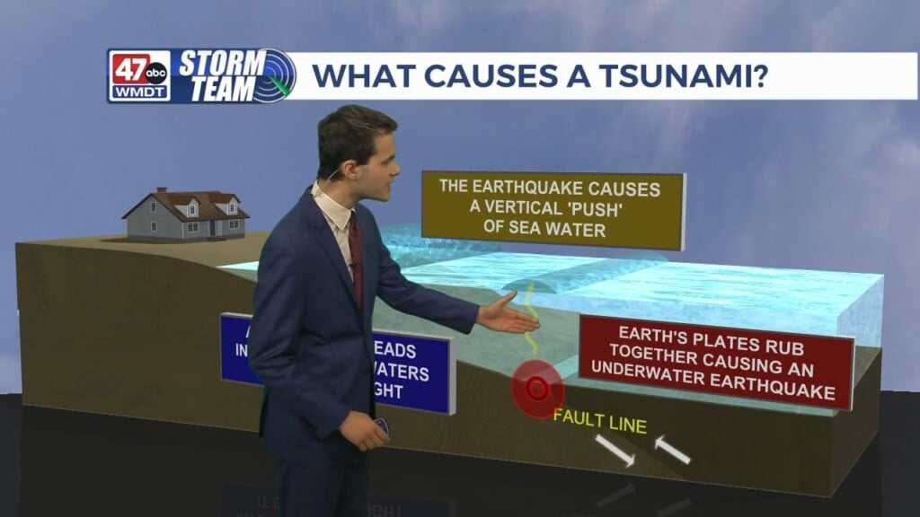
Weather Tidbits: Drought Monitor Classification
This Weather Tidbits explores the 5 classifications of the Drought Monitor. The Drought Monitor is a map that shows which parts of the United States are in drought. It’s released every Thursday; and its a team effort between the National Drought Mitigation Center, NOAA & the Department of Agriculture. The Drought Monitor consist of five classifications from D0 to D4. D0 or abnormally dry is the lowest level; which means land that is going into or coming out of drought. D1 is a moderate drought; where water supplies may be low & damage may occur to crops or pastures. When a severe drought or D2 affects an area; water shortages are common & crop & pasture losses are likely. An extreme drought or D3 deals with widespread water shortages & major losses to crop & pastures. Lastly an exceptional drought or D4, is when shortages of water in streams, reservoirs & wells can lead to water emergencies.