An Update on El Niño
El Niño is still active and making an impact across the globe. It is actually the biggest El Niño event in twenty years, based on sea surface temperatures in the Pacific Ocean.
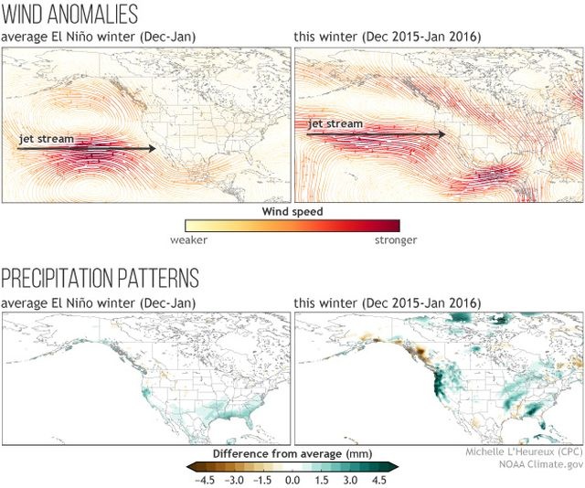
Michelle L’Heureux compared the average El Niño wind anomalies and this winter’s anomalies, as well the precipitation patterns. She made a point that although no single year will match up exactly with the average El Niño pattern, it is important to take note of the small details.
The Pacific jet stream is more “southward-shifted, eastward-extended” during El Niño, which can be seen in the upper left picture. This typically drives more moisture into California, which results in more rain. The pattern described can be seen in this year’s jet stream (image on the top right), resulting in wetter conditions in the northern part of California and for the Pacific Northwest.
This year’s pattern does not perfectly match the typical pattern but El Niño is definitely there. L’Heureux describes it as a “temperamental kid in art class who can’t quite stay in between the lines with his finger paint.” Meteorologist are predicting the future and El Niño is talked about so often because it is the most predictable long term pattern. It is important to note that there are different weather and climate patterns, which provide distractions to El Niño.
While El Niño mainly impacts the U.S. from December to February, the pattern doesn’t consistently stay in one place. Even the small variations from month-to-month make a difference on the weather impacts.
For more information on this article click HERE.