Was it Hail or Snow? What Happened Over the Weekend?

A lot of snow and hail reports came in to the 47ABC Weather Center on Saturday. Temperatures were only in the 30s and 40s during the day, so it was cold enough for wintry precipitation in many areas.
The most popular and most widespread report was definitely hail, but was it really hail? Hail is typically involved in more convective events such as thunderstorms. They measure at least 5 millimeters in diameter and are sometimes larger. Hail forms when water droplets build up and freeze together high up in the clouds where temperatures are below freezing, typically a thunderstorm cloud. A downdraft then pushes it down to the surface. It typically looks like a bunch of little ice cubes, but in a circular-like shape.
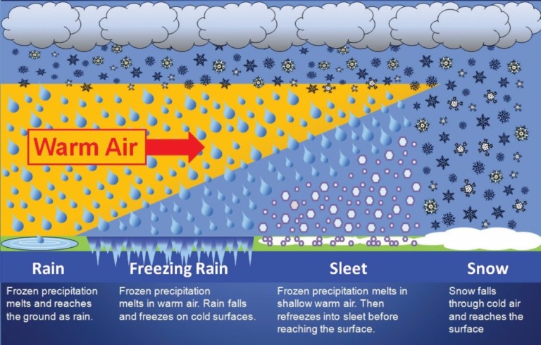
Sleet forms when snow falls from the clouds high up in the atmosphere. As it falls, it passes through a warm layer which causes the snow to melt. The melted snow falls into another pocket of cold air close to the surface where it then refreezes into little ice pellets called sleet. Sleet is usually smaller than 5 millimeters, has a clear look to it, and has a circular shape. Some of you may have seen sleet this weekend as well.
Graupel or snow pellets is what most of us likely saw. So what is it? Graupel is commonly mistaken for hail and so is sleet, but they are all different. Graupel forms when snow flakes fall from the clouds and collide with supercooled water droplets. These droplets attach themselves to the snow flake and then take a ride down the surface. They are small white circular pellets that are very soft and can be easily crushed in your finger.
The easiest way to tell the difference between graupel and hail is by looking at its size and texture.

Here are a couple pictures viewers sent in over the weekend…

(Margaret – Ocean Pines, MD)

(Doug – Greensboro, MD)


