Weather Tidbits: The 40/70 Benchmark
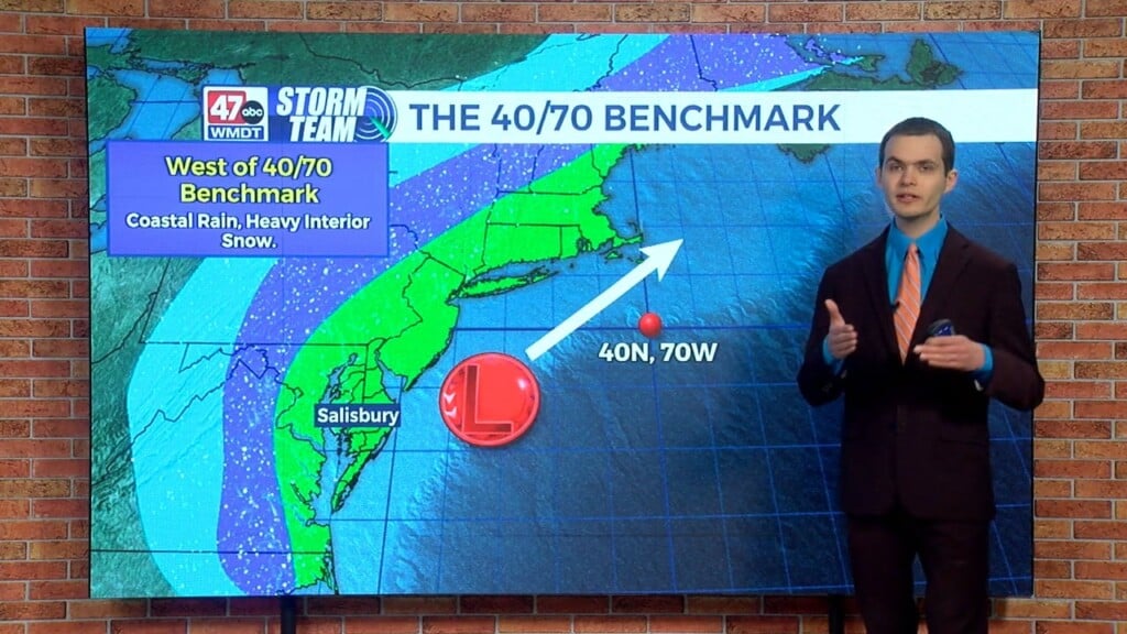
We’ll be discussing the 40/70 benchmark in this edition of Weather Tidbits. The 40/70 benchmark refers to the location 40 degrees north latitude and 70 degrees west longitude. We use this as the sweet spot to determine the potential impacts of a coastal storm, specifically a winter storm, and the snowy impact it has on various locations in the northeast. If the low pressure system tracks toward the west of the 40/70 benchmark, we usually get rain from the I-95 corridor points east closer toward the coast while the heavy snow remains over the interior. If the low pressure system tracks east of the 40/70 benchmark, then the snow is lighter and only confined to areas closer to the coast. However, if the low tracks over the 40/70 benchmark, then we get heavy snow along and east of the I-95 corridor. The most impactful northeast snow storms, like the blizzard from February 22–24 of 2026, took this track over the 40/70 benchmark.