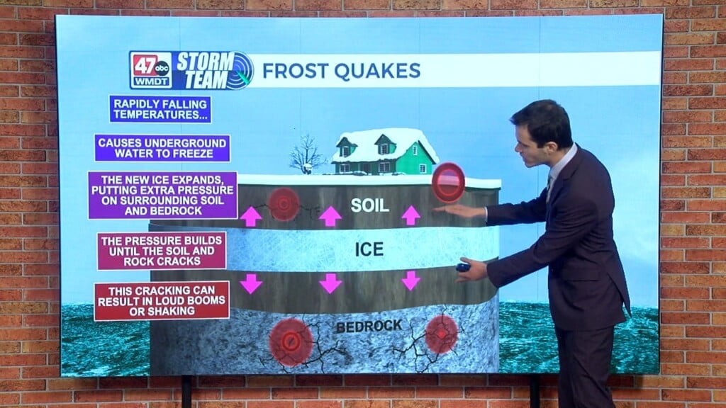
Weather Tidbits: Pyrocumulonimbus Clouds
This edition of Weather Tidbits is going to be discussing pyrocumulonimbus clouds. Pyrocumulonimbus clouds are thunderclouds that are created from intense heating of the Earth’s surface. The process is similar to that of a cumulonimbus cloud during a hot and humid summer afternoon, only this time the updraft associated with the developing cloud is much more vigorous given the heat from the fire. The prefix ‘pyro’ means fire in Greek. These clouds are often associated with wildfires, which causes a plume of hot air and smoke to rise. As the air rises, it cools and allows clouds to form. In an unstable atmosphere, a thunderstorm can develop. The resulting rain evaporates due to the surrounding fire and cools the air, which can produce a downburst wind gust. The lighting can also spark new fires.