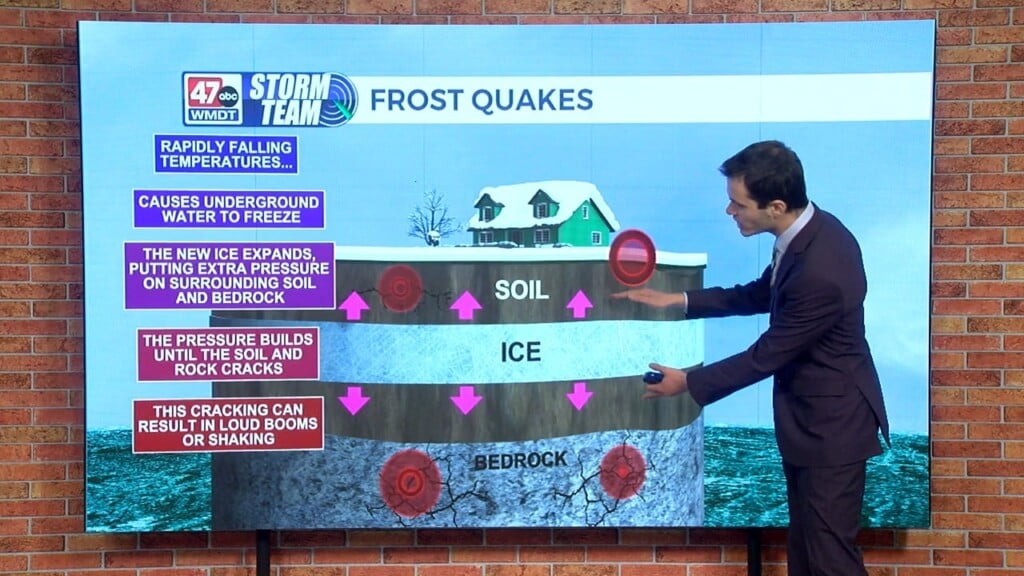
Weather Tidbits: Guideline for Winter Storm Forecasting
In this edition of Weather Tidbits, we will be discussing the general timeline behind winter weather forecasting and how it works. The process first starts off with recognizing the weather pattern as a whole 6 to 8 days out from a projected snowfall event. This can include analyzing the jet stream, and its configuration, as well as analyzing pieces of energy in the atmosphere that may interact to enhance winter storms. We call these energy pieces shortwaves. 4 to 5 days out, we start to really observe forecast model trends and consider the different possible scenarios at play. 2 to 3 days out, we can start nailing down the precipitation type, supposing mixing will be an issue, and give an idea on the first call snowfall totals. The day before or the day of the snowfall, forecast refinements can be made, and local impacts can be delivered.