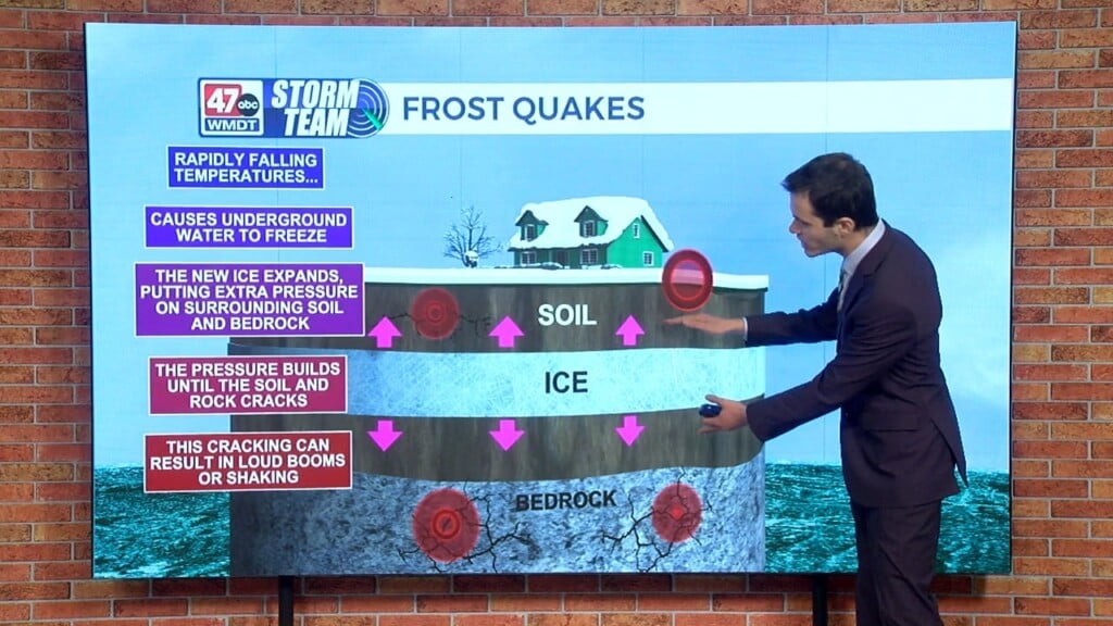
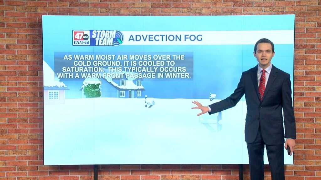
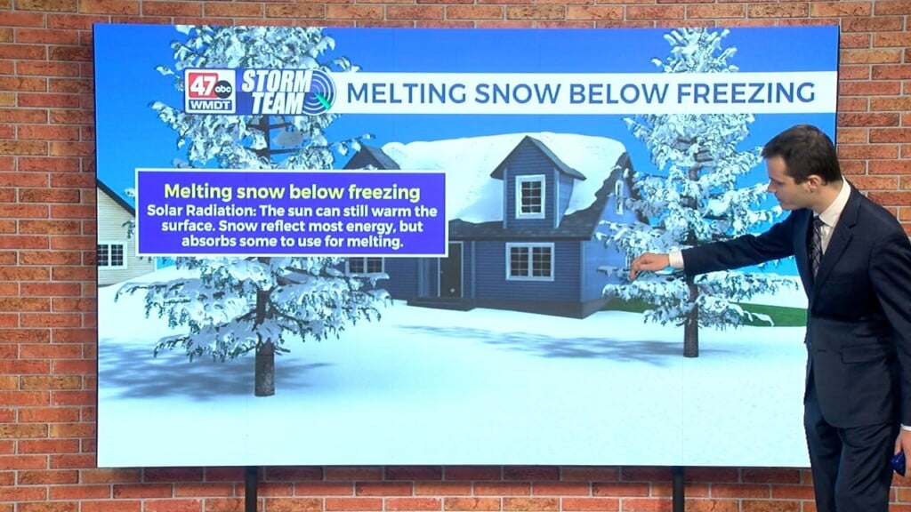
Weather Tidbits: Lake Effect Snow
This edition of Weather Tidbits discusses lake effect snow. Lake effect snow is common in the Great Lakes region during the fall and winter. It occurs when cold air from Canada or the Arctic Circle moves over the open waters of the Great Lakes. As the cold air passes over the unfrozen and relatively warmer waters of the Great Lakes, warmth and moisture is forced upward due to generated instability in the lowest portion of the atmosphere. The air rises, clouds form and grow into narrow bands of snow that can produce very heavy snowfall rates, sometimes 2-4 inches an hour or even greater. The wind direction is key in which areas will receive snow. One town may see heavy snow under one of the snow bands, while a town just one or two miles away could have a bright sunny sky.