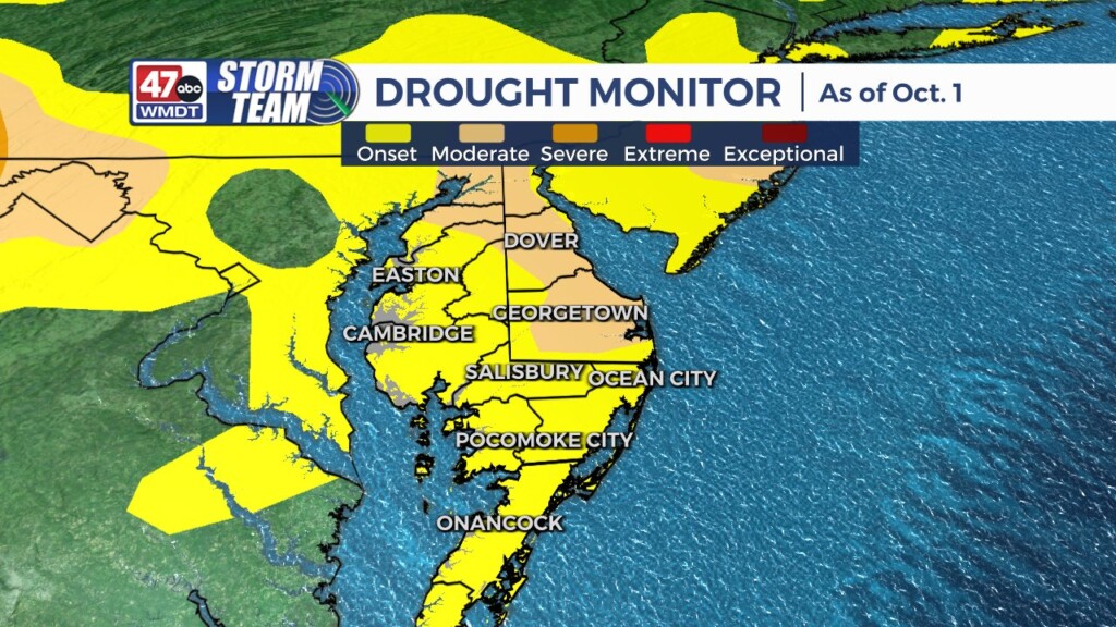
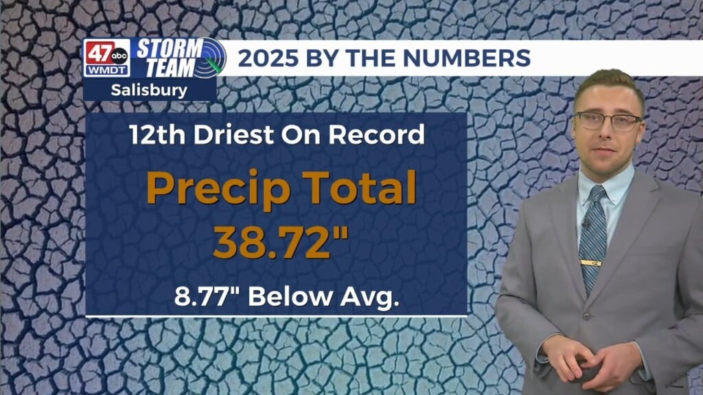
Drought expands across Delmarva
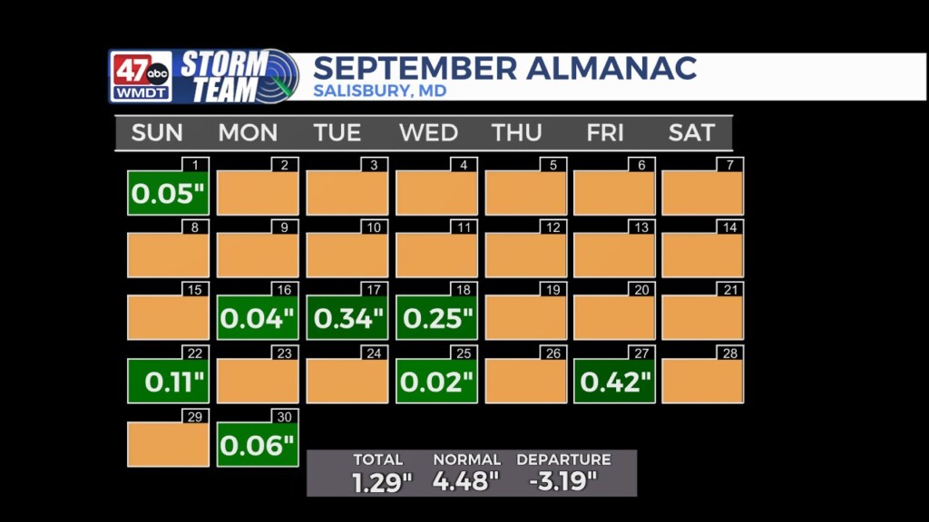
For most of Delmarva, September was an exceptionally dry month. Most instances of wet weather occurred in the second half of the month, but it wasn’t much. In Salisbury, a paltry total of 1.29″ left the area over 3″ in the red for the monthly average. The only exception on Delmarva happened when slow moving storms associated with the remnants of Helene brought several inches of rain to Ocean City and parts of eastern Worcester county. On such a small scale, isolated heavy rain does not help with the overall drought conditions.
The sunny days and bouts of low humidity that are common in early fall are typically welcomed by most – and we will be seeing a lot of those days in the near future. But as is the case with most weather trends, there is a downside, and this will only hasten the drying of interior Delmarva as we head further into October.
How about the upside to bad weather trends? Tropical systems can be drought busters for the Mid-Atlantic in the fall. The track of what will likely be Hurricane Milton in the gulf is forecast to reemerge in the Atlantic after passing through Florida sometime in the middle of next week. This will have to be watched closely. However, as of this weekend, model trends suggest this system will push out to sea as dominant high pressure controls the eastern seaboard with dry weather.
Heading into mid-October, much of the country is looking at below average precipitation. Fall cold fronts can usher in punches of considerably dry air from Canada, and this trend looks to continue.


