Jan. 15-16: Snow and ice across Delmarva
For many areas across Delmarva, Monday’s snowfall was the first measurable event in almost 2 years. And typical for the eastern shore, the wintry precipitation that also included a round of freezing rain for some spots on Tuesday, wasn’t the result of a major coastal storm, but rather a smaller scale convergence zone created by milder ocean air buffering up against much colder air that had settled into the Mid-Atlantic.
.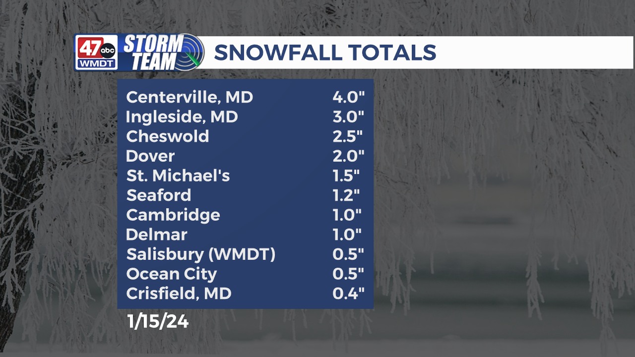
Up to 4″ of snow fell in far northern and northwestern areas of the peninsula, while places along the mid shore of Maryland and in central Delaware received around 1-2″.
At least an inch of snow fell across much of lower Delaware, with 0.5″ to 1″ snow totals around Salisbury and nearby areas. Even in southern parts of the lower shore, from Crisfield to Pocomoke City, a small mount of snow accumulated on grassy areas. Also not left out were the beach areas along the coast, with Ocean City to Fenwick Island reporting 0.5″ to 1″ of snow. Only spots far south into the Virginia tip of Delmarva, in Accomack and Northampton counties, were there areas that did not receive any measurable snow.

On Tuesday, many areas in the upper shore of Maryland and central/northern Delaware remained below freezing as warm air wedged aloft, causing periods of freezing rain. Light amounts of ice accrued in these areas through Tuesday afternoon, while temps remained above freezing further south allowing for rain to melt the snowfall from the previous day. Eventually, the cold air won the battle as temps dipped well below freezing Tuesday night causing re-freeze across the area, leaving slippery roads and bitterly cold wind chill values in the single digits into early Wednesday morning.