Today’s Forecast: October 27, 2021
** Coastal Flood Advisory in effect from 5 AM – Noon Thursday. **
** Coastal Flood Watch in effect from 4 PM Thursday – 8 AM Saturday. **
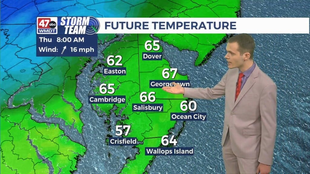
Tonight turns partly cloudy late with lows getting down to around 50 degrees. Thursday will start with some sun before clouds increase through the afternoon hours. Highs will be in the mid 60s.
Temperatures will remain in the mid 60s on Friday with gusty winds and periods of rain as another low pressure system moves into the area. Some of the rain will be heavy and the winds strong, especially later in the day. Gusts could climb to 40 mph and rainfall amounts may be between 1-2 inches in spots. Coastal flooding and beach erosion are concerns as well due to persistent easterly winds.
Isolated showers are in the forecast for Saturday under partly sunny skies. Highs will be in the mid 60s. Halloween Day turns mostly sunny with highs in the mid 60s.
Monday and Tuesday, highs will be in the mid 60s under sunny to mostly sunny skies. Wednesday will be partly sunny with highs in the low to mid 60s.
Have a great night!
-Daniel