Today’s Forecast: February 10, 2021
**Winter Weather Advisory in effect for Wicomico County and points north tonight through midday Thursday. **
** Winter Storm Watch in effect for Dorchester, Wicomico, Somerset, and Worcester counties Thursday afternoon through Friday afternoon. **
Cloud cover will increase as we head into tonight with lows in the low 30s. Rain and snow will move in, and a dusting or so is possible in Salisbury, with as much as a few inches possible north near Dover. The wintry mix will continue into early Thursday, then dry out during the mid day hours and early afternoon. Highs will be in the mid to upper 30s under cloudy skies. Later in the day and into Thursday night, more precipitation will move in, likely being all snow with more accumulation possible, especially across southern Delmarva.
Light rain, snow, and sleet continues into early Friday, but it will move out by midday. Highs will be in the low 30s under cloudy skies.
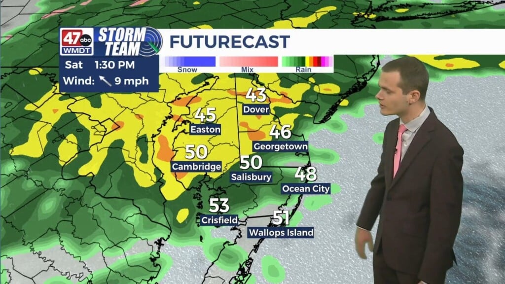
Saturday will be mostly cloudy with highs in the mid to upper 30s. There is the possibility for wintry precipitation that could continue into early Valentine’s Day with highs around 40 degrees. Most of the day looks dry.
Monday, highs will be in the low 30s with partly to mostly cloudy skies. Tuesday, highs will be in the mid 40s with a chance for a rain and snow mix under mostly cloudy skies. Wednesday will be partly sunny and cooler with highs near 40.
Have a great day!
-Daniel