Today’s Forecast: May 14, 2020
Partly cloudy skies tonight with lows in the upper 50s and low 60s. After a warm front moves through later this evening, we will warm up into the mid 80s for the area tomorrow, but the beaches will remain cool in the mid to upper 70s. Friday will have mostly sunny skies. Make sure you wear sunscreen and stay hydrated if you go outside.
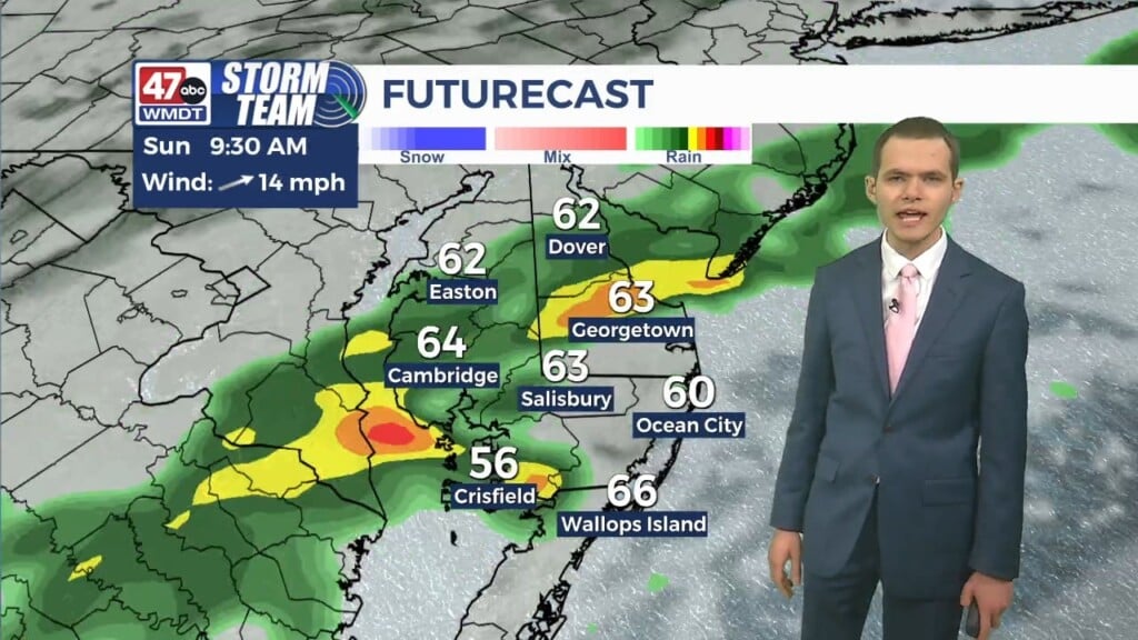
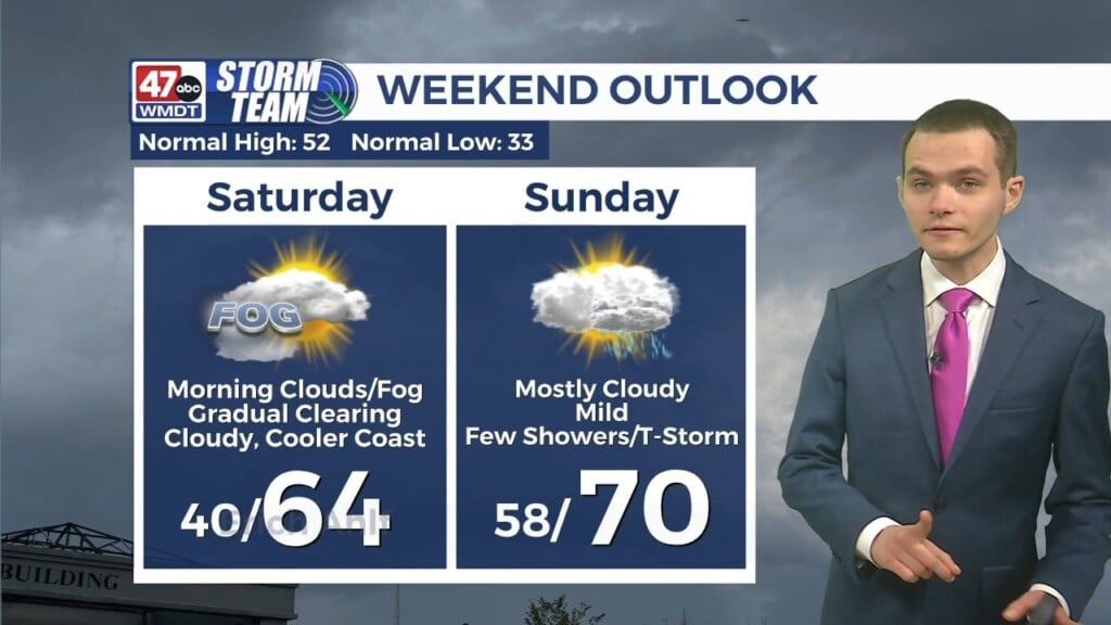
Saturday will remain warm in the upper 70s to low 80s with partly sunny skies. We will cool off Saturday night into the mid to upper 50s as a backdoor cold front moves in from the north. Sunday is looking cooler with highs in the upper 60s to low 70s with mostly cloudy skies. There is a possibility for showers and maybe even a thunderstorm this weekend.
The beginning of the work week is looking similar to this weekend. On Monday, our highs will remain in the upper 60s to low 70s and skies will be partly sunny. Overnight, there is a chance for scattered showers and storms. Tuesday will be unsettled as a front begins to move towards the Eastern Shore. Mostly cloudy skies, scattered showers and highs in the low to mid 60s can be expected on Tuesday. By Wednesday, mostly cloudy skies and highs in the mid 60s persist with a possibility of showers. Thursday, we’ll warm up a bit into the mid to upper 60s for the area, but there will be mostly cloudy skies and the possibility for showers. Low temperatures for next week will remain in the 50s.
Have a great night!
-Daniel