A Timeline of Possible Tornado in Salisbury
Officials are investigating damage from a possible tornado in Salisbury than happened on Monday afternoon.
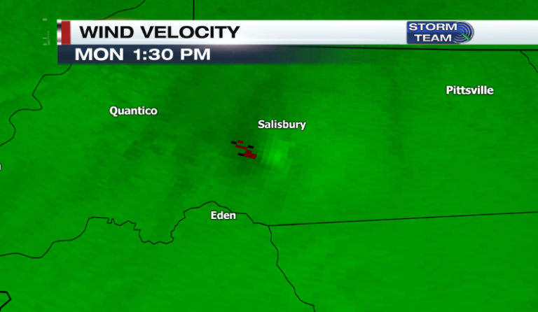
The National Weather Service (NWS) issued a Severe Thunderstorm Warning on Monday, August 8 at 1:37 PM for Central Wicomico County. Within the warning there was a precautionary to remain alert for a possible tornado. Soon after the warning there were reports of power lines down, cars flipped, and damage to structures.
The circulation within the storm developed quickly from what was an unorganized area or moderate to heavy rain, according to the NWS. There was also little to no lightning associated with the area of rain and the circulation was shallow.
The storm showed some signs of rotation but because it wasn’t tight enough a Tornado Warning was not issued. Although there was weak rotation, the tropical-like environment is likely what caused the spin up in Salisbury.
On Monday most of Delmarva was under a “Slight Risk” for Severe Thunderstorms. The main concerns within the “Slight Risk” area on Monday were damaging wind gusts, heavy rainfall, and frequent lightning, but an isolated tornado could not be ruled out.
It is important to stay weather aware anytime the local area is under a “Slight Risk” or higher.