DSP announce new “mapping” system for Delaware crime
Members of the Delaware State Police say they are incorporating technology in efforts to engage with the community to prevent crime.
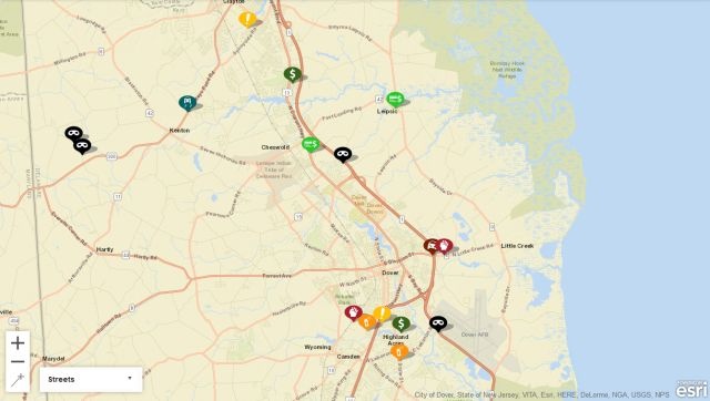
A new map system works like a virtual neighborhood, police say, and Troopers document and update crime details, specific to the location in which the crime occurred. This way, community members can see what is happening around them, simply by checking out the details on their internet-connected device.
According to DSP, mapping data can also act as a deterrent to crime and serve as a safety measure in community policing to make people more engaged, aware and cautious. The data is location-specific, so community members can tell what is going on in relation to their homes, as well as area schools, shopping centers, etc.
The way the system works, is Troopers will update information on the map every 24 hours, and the information on the crimes will be reflected on the map for 180 days after, so folks can reference the data even months later.
Each crime is detailed with a specific marker, depicting what kind of incident occurred. Robberies, burglaries, assaults, etc., have their own icons on the map.
The website can be accessed by going to the official Delaware State Police website http://dsp.delaware.gov/ and clicking on the Crime tab.