Sussex County reportedly escapes worst effects of coastal storm

According to the Sussex County Emergency Operations Center, post-Tropical Cyclone Hermine tracks farther east than expected, but tidal flooding remains concern into Labor Day.
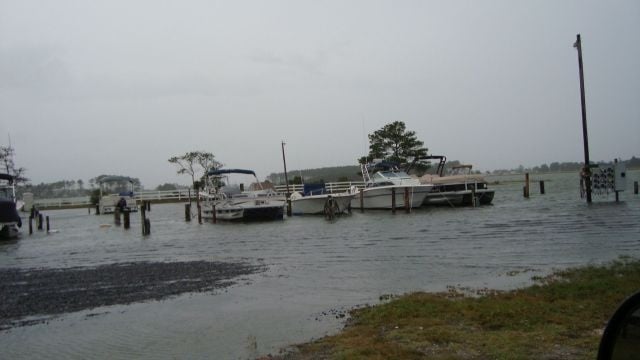
Post-Tropical Cyclone Hermine has apparently charted a course farther east into the Atlantic, sparing Sussex County and the Mid-Atlantic from heavy rains and storm-force winds. But, EOC says its presence may yet be felt through Labor Day and beyond as rough seas carve away at area beaches and still threaten to cause flooding in some low-lying communities.
A tropical storm warning remains in effect for Sussex County until further notice. However, as the storm is more than 300 miles offshore, the effects most likely to remain in its wake are rough seas, dangerous rip currents, and minor to moderate coastal flooding during times of high tide, forecasters say.
“This is certainly a better outcome given the forecasts leading up to today. But just because the sun is shining doesn’t mean our guard should go down,” Sussex County Emergency Operations Center Director Joseph L. Thomas said. “Forecasts can change quickly, so the public should keep an eye on Hermine until it pulls away for good or dissipates.”
The Sussex County Emergency Operations Center says it continues to monitor the situation, and remains in contact with Delaware emergency planners, the National Guard, and local fire companies to have personnel and equipment on standby for any response, if needed.
The EOC reminds those in vulnerable and low-lying areas to be prepared for possible flooding, particularly during high tides Sunday night and late Monday morning along the Atlantic beaches and back bays.
Areas that historically flood, including Long Neck, Broadkill Beach and Primehook, could see minor to moderate flooding – one to three feet above normal – through at least Labor Day morning, possibly longer if the storm lingers off the coast through mid-week as forecasters expect. As the storm moves north and east, winds will reportedly turn from the northeast to a more northerly and then northwesterly direction, helping to drain water that has been pushed ashore and into the lower Delaware and Inland bays.
For updates, stay tuned to 47ABC, as well as the Sussex County website.
The public also should monitor the National Weather Service and the National Hurricane Center for the latest forecasts.


