Graupel vs. Hail
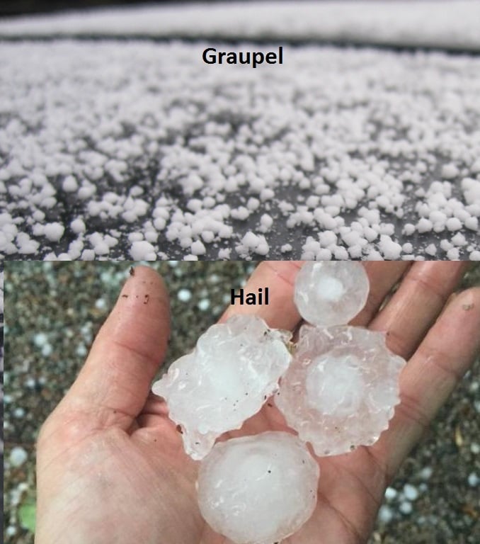
Most people don’t know about graupel even though we had some early in April. For graupel we start with snow falling out of a nimbostratus cloud. The snow then falls through super cooled water droplets, which stick to the snowflake and freeze. This allows for the snowflake to turn into a soft ice pellet. As graupel hits the ground it can break apart because the ice structure isn’t strong enough to stay together.
Hail begins in a cumulonimbus cloud and starts with a super cooled water droplet that freezes in the upper portions of the cloud. Now of course that tiny ice pellet gets heavy and thanks to gravity it begins to fall. Then a strong warm updraft lifts the ice pellet back into the freezing portion of the cloud. As it goes up other water droplets cling to the surface and freeze to it. It continues this process adding more and more layers until it’s too heavy and it falls out of the cloud. A great way to see how many times the hail stone moved up and down is to look at a cross section of a hail stone. The hail stone can look like an onion with the many layers showing how it gathered more water and re-froze going up and down.
So the big difference between hail and graupel is the type of environment it forms. Winter weather systems produce graupel and hail is formed in thunderstorms.