NASA/NOAA Satellite Animation of Massive Low Pressure System
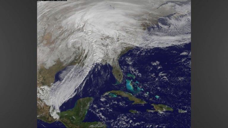
This 30 minute animation is a combination of visible and infrared images from the “massive” low pressure system form December 26-28 that caused severe weather across the southwestern and central parts of the United States. This storm started off in the four corners region and produced tornadoes, heavy rain, flooding, ice, and snow across its path.
The animation created by NASA/NOAA GOES Project at NASA’s Goddard Space Flight Center in Greenbelt, Maryland highlights major events from the storm. One of the main features seen is the line of severe thunderstorms that produced multiple tornadoes near the Dallas-Ft. Worth area in Texas. The Nation Weather Service reported an EF-4 tornado with winds up to 175 mph in Garland, Texas, approximately at 6:45 PM (0045 UTC) on December 27. Another feature visible is the rain the that spread across western Arkansas the night of December 27 that lingered into early December 28, producing 6 inches of rain.
Click HERE for the YouTube link of the animation.