T.S. Joaquin & Possible Flooding Rains by Friday
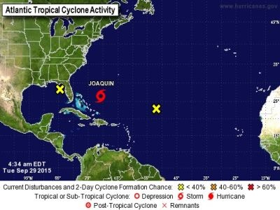
A very unsettled weather pattern will be around this entire week. The Gulf of Mexico is active where there is currently a Tropical Invest near the FL Panhandle. The Gulf is bringing a lot of humidity and extra moisture into the area, while at the same time a cold front is moving in from the west, plus Tropical Storm Joaquin has developed in the Atlantic and is heading towards the region. You can see a few of the systems that could impact our weather on the map below.

A cold front will bring a big cool down to the area by Thursday and Friday, and then it will stall off the coast and slowly drift back to the west towards Delmarva. This system will interact with a series of low pressure systems and extra moisture moving in from the Gulf and the Atlantic. The result will be some very heavy rain by Friday. Some models are forecasting several inches of rain with this system. The GFS model below shows at least 3 inches falling within a 24 hour period from Fri AM to Sat AM. Rain like this will cause flooding concerns.

Not only is the rain expected to be a problem, but there will be breezy winds as well Friday and Saturday, especially along the beaches. The same GFS forecast model is showing wind gusts up to 38 knots in some areas, which converts to about 40-42 mph.

Then comes the question of Tropical Storm Joaquin and where it tracks. Some models bring the system very close to Delmarva by the end of the weekend bringing more heavy rain and gusty winds. Here’s a look at the latest information regarding its forecast track. Each line below is an individual forecast model and most of them have Joaquin making landfall in the U.S near New Jersey.

Another thing to note is that the rain will definitely be the biggest concern with this system. The Weather Prediction Center is forecasting between 5-7 inches of rain over the next seven days across Delmarva. That is significant. See below:

Lastly, Joaquin will likely lose its tropical characteristics as it travels further north near Delmarva, but that doesn’t mean it can’t cause major problems. Remember Sandy a few years ago? That wasn’t a tropical system when it made landfall. Pay attention to the weather over the next few days as we fine tune the forecast. This is a very difficult weather pattern and a lot can still change. Right now, just be aware that we could be in for some very heavy rain by the end of the week and into the weekend.
-Daniel