Tropical Storm Erika
As of 9:00pm 8/25/2015:
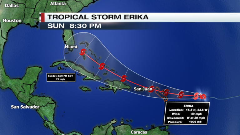
Tropical Storm Erika has formed in the Atlantic basin and has increased in the last few hours. Currently at 15.8 N and 53.6 E (See attached map) with maximum sustained winds of 40 mph and is moving west at 17 knots (20 mph). A Tropical Storm Watch is in effect for the Leeward Islands, meaning tropical storm conditions are possible within the next 48 hrs.
Microwave data shows that the tropical storm has been ingesting dry air in the mid-levels, which will help with to slow some strengthening in the next 48 hours. Also a mid-level subtropical ridge just north of Erika will direct the cyclone on more of a West-northwesterly track. However the forecasted intensity of the storm is somewhat uncertain.
Erika is expected to impact the Leeward Islands late Wednesday and early Thursday morning. It will bring winds upwards of 50-60 mph and 2-4 inches of rainfall across the islands. Puerto Rico will see the storm with 60 mph winds around Thursday evening. Erika then continues to track WNW through the weekend and is expected to intensify to hurricane status Sunday afternoon. By the time Erika may become a hurricane its center is projected to be 150 miles ESE of Miami, FL.