Aircraft to Improve Hurricane Forecasts now on Delmarva
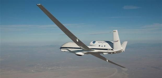
Scientists and pilots are now ready to begin the NOAA-led mission to improve hurricane forecasting. On August 22, the Global Hawk unmanned aircraft landed at NASA’s Wallops Flight Facility in Wallops Island, Virginia, where NOAA and NASA will work together on a mission called Sensing Hazards with Operational Unmanned Technology or SHOUT.
The mission has begun and will last through the end of September. NOAA, NASA, and partners will send out a series of Global Hawk flights over the Atlantic Ocean that will collect real time data on temperature, moisture, and wind speed and direction. The data will go directly into the National Weather Service forecast models to be used by the National Hurricane Center.
According to NOAA, the Global Hawk is equipped with instruments to profile the inner parts of a hurricane, including:
- Dropsondes developed by NOAA and the National Center for Atmospheric Research that are released from the aircraft to profile temperature, pressure, wind speed and direction
- NASA-developed radar designed to measure precipitation and wind speed
- Microwave sounder from NASA’s Jet Propulsion Laboratory to take vertical profiles of temperature and humidity
- A NASA lighting instrument package to measure the electric field of thunderstorms
The Global Hawk, managed by NASA’s Armstrong Flight Research Center in California, is unique in that it flies higher and longer that any manned aircraft. It can collect data from 60,000 feet, which is 20,000 feet higher than a manned aircraft, and can gather data for up to 24 hours. SHOUT is funded by the Disaster Relief Appropriation Act of 2013, passed by Congress after the wake of devastating Hurricane Sandy.